COLEMAN CEMETERY, COLEMAN COUNTY, TEXAS
The information in this cemetery
listing is as published in the three volume,
"Coleman County Cemetery Inscriptions,
completed in 1988 by Judia and Ralph Terry and Vena
Bob Gates.
I had updated some of the information, but now depend on
others by using the FindAGrave.com
website.
Each cemetery listed below has a link to its FindAGrave
listing.
Click here to go to Coleman Cemetery
on FindAGrave.
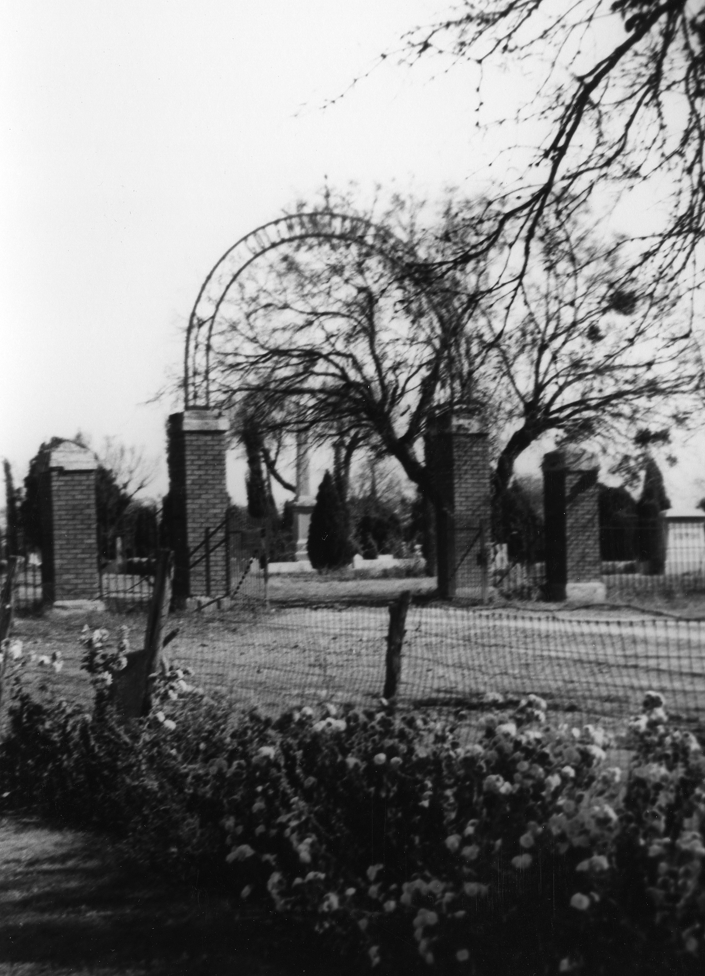
Coleman Cemetery Entrance - about 1905
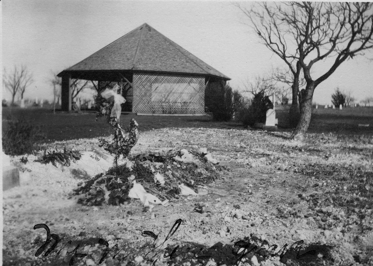
Old Tabernacle at Coleman Cemetery - 1913
Overall Rest was built at this location
.................................................................................................................
HISTORY AND DESCRIPTION OF THE COLEMAN CEMETERY
The Coleman Cemetery
began with the establishment of the city of Coleman in 1876 or
soon after this date. From old histories, we have learned
that the first man to be buried in Coleman was gored by a bull
on Home Creek; his name was Shannon. He was cremated 15
years later by J. L. Spicer, and his ashes took north by his
father in a silver urn to be placed in a vault by his
mother. The second man was killed by a drunken man on the
street between what is now Bowens Drug and the Carousel.
J. L. Spicer buried all the people here for 15 years. It
is not known if the early burial ground was where it is today,
but it is felt that it was. There was no purchase of land
for a cemetery until 1877 or 1878, when J. F. Gordon headed a
committee to arrange for a cemetery. The committee
purchased thirty acres at 25 cents per acre, located about a
mile south of the courthouse. In 1880, the cemetery was
divided into IOOF, Mason, Citizens, and Negro sections. It
was not known if there was any sort of a cemetery association at
that time or if everyone took care of their own plots.
By 1921, the cemetery was
in need of additional room. In October of 1921, 2500
square feet were donated for use by veterans of World War I (see
Map Page 14 for additional history). The need for care was
also realized, as the Coleman Cemetery Association was chartered
in December of 1921 for "the maintenance of a public cemetery,"
which was to exist for 50 years. In December of 1923, an
additional 8 1/4 acres was purchased for cemetery use. By
1938, however, the City of Coleman had grown to a population of
over 5000, which brought it under a Texas state constitutional
provision that the city would have to maintain a cemetery for
its citizens. In 1939, a Cemetery Committee representing
the citizens, Odd Fellows, Masons, and American Legion deeded
the entire cemetery to the city, with the reservation that the
fraternal areas be restricted to its members. In 1945 the
area known as the "East Extension" consisting of about 10 acres
was added (see map pages 12 and 13 for additional
history). For those of you who do not remember, the
Comanche Road at that time ran east from Guadalupe Street (which
was the Shields Road), beginning where Hollywood Drive is today,
turning southeast at the southeast corner of the original
cemetery (now known as the southeast corner of map page 9); so
in 1945 this road was the south boundary of the cemetery.
Since that time, the Comanche road has been rerouted and
additional land has been purchased, not all of which has been
developed. There are now 72 acres, which are fenced, and
additional land outside of this fenced area.
As of 1988, the cemetery
contained at least 8000 marked graves and hundreds, possibly
thousands, more that are unmarked, with many others being added
since that time. The oldest graves marked with inscribed
stones have the date of 1878 and 1879. There are six
stones with these years inscribed. Three are located in
the center of Map Page 3 and the other three are found in Map
Page 9, all along the south side, each in different
sections. Some of the most beautiful stones are those
belonging to Woodmen of the World, one of the best examples is
that of W. P. Rascoe, found in Map Page 10, which has
extraordinary carved detail.
Many of the older
sections were not well laid out, thus causing problems in
keeping the lots and rows in logical order in recording these
graves. We have attempted to set out single rows or rows
of lots, whichever applies in each case, for aid in locating
graves and keeping graves of the same family together.
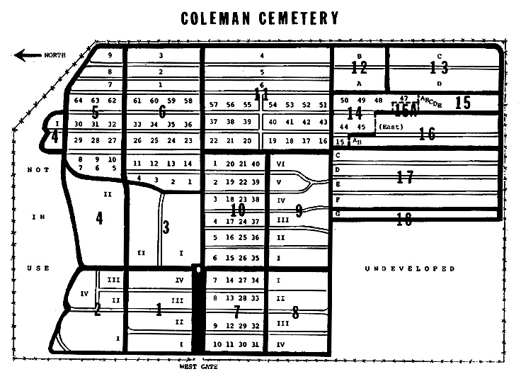
Where there is a row number, it has been added by the compilers
of this book and is not used by the City of Coleman on their
map, which was drawn up by Pam Wood, a Coleman High School
student, during two summers in the late 1960's for the City of
Coleman. There are errors in this map as to proportion and
lot designation. (The map used in the published book and
below was drawn by Judia Terry, using an aerial photograph as a
guide.) This map is broken down into 19 large, detailed
pages, making up the various parts of the cemetery, hence the
term "Map Page." This map uses Map Page numbers, sections,
and lot numbers, to which we have adhered in the published book
and in this internet presentation. The beginning place of
each Map Page and Section will be noted. In some Map
Pages, it was advantageous to come back to the starting road for
each new section, and on other map pages, it worked out better
to make a U-turn at the end of the first half of a section and
work in the opposite direction for the second half. The
method used will also be explained at the beginning of each map
page or section to which it applies.
For many years, Paul
Hubbard was caretaker of the Coleman Cemetery. Most of his
records were kept in his head. Paul retired in May of 1984
and suffered a fatal heart attack in 1987. The cemetery
had several caretakers until February of 1985 when Brad Staggs
assumed the job. Brad has done an outstanding job in
getting the cemetery and its records in good shape. We
want to thank him in assisting us in keeping recent burials
recorded. Since 1988, others have worked to keep the
cemetery organized.
To get to the cemetery
from any street in Coleman running north and south, go to
Ninth Street and turn east. This street will dead end into
the cemetery.
|
Coleman Cemetery Map in 1988
Original map drawn by
Judia Terry, using an aerial photograph as a guide
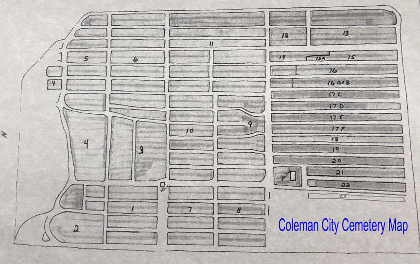
Coleman Cemetery Map about 2018
Furnished by Robert Lowe
For More
Information about the recording of this cemetery,
Go To The
Explanation and Abbreviations Page for Coleman
County, Texas Cemeteries
|
|
The records
shown here were originally published in the a 3 volume
set, Coleman County Cemeteries Inscriptions,
and were copied and compiled by Vena Bob Gates, Judia
Terry and Ralph Terry, and were published in 1988 by
Terry Studio, P. O. Box 958, Coleman, Texas 76834, and
was copyrighted 1988 by Ralph Terry. All rights
are reserved, including any reproduction for
profit. Copies of the published works, Coleman
County Cemeteries Inscriptions (published in
1988) can be purchased from Ralph Terry at the above
address.
|
GO TO THE COLEMAN
COUNTY, TEXAS CEMETERY DIRECTORY