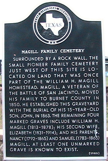
Surrounded by
a rock wall, the small pioneer family cemetery just west of this
site is located on land that was
once part of the William H. Magill homestead. Magill, a veteran
of the Battle of San Jacinto,
moved his family to Burnet County in 1850. He established this
graveyard with the burial of his
15-year-old son, John, in 1863. The remaining four marked graves
include William H. Magill
(1813-1878); his second wife, Elizabeth (1831-1914); and his
parents, Nancy (1792-1865) and
Samuel (1783-1865) Magill. At least one unmarked grave is known
to exist. (1985)
[photo
of cemetery and marker]
-
- MAHOMET
CEMETERY - LOCATION:
10 miles NE of Bertram on FM 243.
- This cemetery, with interments
dating back to the 1850s, became a community graveyard for the
Sycamore Springs and Mahomet rural communities. In 1909, J.W.
Williams and J.W. and Nellie Greer deeded the cemetery property
to the community of Mahomet. Among the hundreds of people buried
here are many of the area's pioneer settlers and their
descendants and veterans of wars ranging from the Mexican War
(1846-1848) to the Vietman War. Mahomet Cemetery remains active
and is maintained by an association of descendants of people
buried here. Sesquicentennial of Texas Statehood 1845-1995.
- MAHOMET-SYCAMORE
SPRINGS COMMUNITY - LOCATION:
RR 243 right-of-way, 2.5 miles W. of US 183, 6 miles NE of
Bertram.
Settlement in
this part of Burnet County began in the 1850s. Two early
communities were
Mahomet and Sycamore Springs, originally located 8 miles from each
other. Pioneers of Mahomet were George Ater, William G. Hall, and
Mr. Sanford, while Sycamore Springs was settled by the Smart,
Stewart and Williams families. Although Sycamore Springs once had
3 gins, a general store, a school, and 2 churches, little evidence
of the community now remains.
Much speculation has taken place over the years concerning the
origin of the unusual name of the Maohmet settlement. Research now
indicates that the town was probably named by first postmaster
George Ater, who came to Texas from Mahomet, Illinois. Both the
original Mahomet post office and an Austin-Lampasas stage stop
were located at his home.
The Mahomet
Christian Church, moved from Sycamore Springs in 1899, continues
to worship near this site. Mahomet is also the home of the Mt.
Horeb Masonic Lodge, which was relocated from nearby Williamson
County in 1915. The community burial ground (.5 miles SW) dates
from the early 1850s.
The history of
these two related settlements is an important part of Burnet
County's heritage. (1968, 1985)
- MARBLE
FALLS DEPOT - LOCATION:
801 US 281 at the intersection with Ave H, Marble Falls.
- The town of Marble Falls was laid outin
1887. Texas Mining and Improvement Company deeded land for a
depot to Austin and Northwestern Railroad. this building was
erected in 1893 and then Southern Pacific Railroad bought the
line and property. Area residents gathered at the depot to
visit and watch for the train. Excursions were offered and
passenger service provided. Hogs, horses, cattle, cedar posts,
cotton, pecans, and hides were shipped to market from here. In
1937 passenger service was discontinued and the depot was
closed in 1968. It was moved to this site in 1976. (1979)
[Photo]
-
-
- MARBLE
FALLS FACTORY SITE - LOCATION:
on US 281, N of Colorado River Bridge, Marble Falls.
The potential
of water power on the Colorado River led town developer Gen. Adam
R. Johnson and Farmers Alliance members to build a cotton mill on
this site in the 1890s. The two-story stone factory, 300 feet long
and 100 feet wide, was erected for the Marble Falls Cotton and
Wollen Company, formed in 1892. New machinery run by hydroelectric
power was installed by the Marble Falls Textile Mills Company in
the 1920s. Woolen goods, surgical gauze, and air conditioners were
made here before the factory was gutted by fire in 1964 and
razedin 1971. (1977) [Photo]
- MARBLE
FALLS POST OFFICE - 1910 BUILDING - LOCATION:
115 Main, Marble Falls.
- Established in 1884, the original Marble
Falls Post Office was built south of the Colorado River.
William P. Cochran, appointed postmaster in 1901, built this
structure in 1910 and leased it to the U.S. Government for use
as a post office. It continued to serve as a postal facility
until about 1950. Constructed of poured concrete, the building
features a central double door with three-pane transom, a
simply detailed cornice, and a stone parapet. Recorded Texas
Historic Landmark - 1989. [Photo]
-
- MARBLE
FALLS SCHOOL BUILDING - LOCATION:
2005 Broadway, Marble Falls.
- Adam R. Johnson donated land at this
site for construction of the present two-story granite
building. Completed in 1891, it originally housed the Marble
Falls Alliance University. Near Backbone Creek, east of this
main building, a wooden boarding house was built for the
students. The property was sold later in 1891 at a sheriff's
sale, but continued to be leased for use as a tuition school.
In 1908 the local voters chose to buy the structure, and it
has been used for classes by the Marble Falls School District
since that date. (1980) [Photo]
- MICHEL'S
DRUG STORE - LOCATION:
216 Main Street, Marble Falls.
- Ernst Gustav Michel (1865-1930), a
native of Germany, and his wife, Lillie Agnes, opened a
drugstore at this site in 1891. After fire destroyed the first
store in 1905, Michel built a 3-story edifice here. The first
floor housed the drugstore and soda fountain. The second floor
was an opera house with seating for 300 people. the top floor
had the family's living quarters. That structure burned in a
fire that destroyed an entire city block in 1927. All four
Michel children who lived to adulthood studied pharmacy. The
Michel family has operated a drugstore at this location since
1891. (1984) [Photo]
- MORMON
MILLS - LOCATION:
South of Burnet about 7 miles on Mormon Mill Road, marker is
in pasture at the Mill site, privately owned.
Site of a settlement made in 1851 by 20 Mormon families under the
leadership of Lyman Wight1796-1858. Here they built homes, lumber
mills, and shops for the manufacture of furniture.
- Abandoned in 1853.
MOUNT BLANC SCHOOL -
LOCATION: on CR 330 about 2.5 miles west of
CR 243
Site of school that served the
community from 1883 until 946, when it consolidated with the
Bertram
School District. The schoolhouse was torn down in
1997.
(2010) [ Photo]
MOUNT
HOREB LODGE - LOCATION:
on ranch road 243 at the Lodge Hall at Mahomet.
Chartered
Jan. 21, 1854. Met in log schoolhouse, erected own Lodge Hall
1856 on
land given by grand master Sam Mather and B.K. Stewart. First
floor
used as church and school. A fire in 1915 razed the
hall. Lodge
rebuilt here in 1916 on land given by G. T. and W. J.
Williams.
(1967)
- MOUNT
ZION CEMETERY - LOCATION:
3.4 miles SW of Bertram on FM 243, then 0.6 miles E on CR 330,
then 0.5 miles N. on CR 330A to cemetery.
John Jennings
(1802-1867), his wife Sarah C. (Sally) (1806-1879) and their
family came to this area in 1851.
The settlement which grew up around their farm became known as
Jennings Creek Community. After
Burnet County was created in 1852, John Jennings was
instrumentall in organizing the
new county government. He was a county commissioner for four
yers.
The oldest documented burial in this
graveyard, which was originally known as the Jennings Family
Cemetery, is that of Mary Ann Jennings (1835-1856). Other early
burials include those of John and
Sally Jennings, members of their family, and neighbors.
- The Jennings Family Cemetery became
known as Mount Zion Cemetery when the Mount Zion Cumberland
Presbyterian Church was built about one-half mile south of
this site in the 1890s. The land
on which the cemetery is situated remained in the Jennings
family until 1944.
Among the more
than five hundred grave markers here are tombstones of veterans
of the Civil War, and the Spanish
American War. A cemetery association incorporated in 1972 cares
for the historic graveyard. (1989)
[Photo]
-
- OAKALLA -
LOCATION: Ranch Road 963, Main Street of Oakalla, 26 Miles NE
of Burnet.
The first settlers in this rich farm
and ranch land arrived in the 1850s. Oakalla Post Office was
established May 19, 1879. Schools were private until a cooperative
was built which provided classrooms on the second floor.
Oakalla boased a doctor, drugstore,
blacksmith shop, and a cotton
gin by 1881. The two-acre school site was deeded in 1890. Worship
was held in the schoolhouse and in brush arbors until 1908 when
Oakalla Baptist Church erected a meetinghouse. The school
consolidated in 1958 with Lampasas and the building became a
community center. (1979)
- OATMEAL
CEMETERY - LOCATION:
5.2 miles SW of Bertram on FM 243, then left on CR 326 0.2
miles, then right on CR 327 0.7 miles.
-
Some of the earliest pioneers of the
Oatmeal community are interred in this cemetery. The oldest
documented burials are those of
Mary Smith and her year-old daughter, Fanny, both of whom
died on September 16, 1854.
Mr. and Mrs. J. L. Roundtree deeded the two acres of land
containing the cemetery in
1871. Among those interred here are veterans of the Civil
War, World War I, and World
War II. An additional land acquisition in 1983 enlarged the
cemetery to three acres. A cemetery
association formed in 1945 maintains the historic graveyard.
(1990)
[Photo]
- OATMEAL
SCHOOL (EARLY) - LOCATION:
Ranch Road W. to Oatmeal, due east of Oatmeal community center
on county road of Creek
-
This building, once a combined school
and church, was erected in 1869 in Oatmeal, second oldest community
in Burnet County. The settlement, founded in 1849, had a
post office from 1853-1876.
This limestone structure was successor to the first school
of 1850. Excepting minor repairs and
additions of a board floor, building looks much as it did in
1869. It is a church today. A third school
build in 1924 now houses a community center.. Recorded Texas
Historic Landmark -1968.
[Photo
of Oatmeal School
- PIONEER
SETTLERS OF BURNET COUNTY (IN MEMORY OF) -
LOCATION: NE
corner of court house lawn in Burnet. Erected by the State of
Texas 1936, with
funds appropriated by the Federal Government to commemoriate 100
years of Texas Independence.
Samuel E.
Holland, first settler, 1848, Logan Vandeveer, Peter Kerr,
William H. Magill, Noah Smithwick,
Jesse burnam, R. H. Hall, General Adam R. Johnson, Captain
Christian Dorbandt, and
to those pioneers who pushed into this wilderness and
established here the first traces of human
habitation, unknown planters sowing seeds for a new
civilization. They marked for us our channels
of trade and industry. (They) Built the first schools and
churches and after the tumult of Indian
depredations and the terrible scars of Civil War, returned and
again took up the ax and plow and
brought new acres into cultivation. Most of them died in
obscurity and were laid to rest in the county
of their adoption. As the rank and file of our pioneers, we
honor their memory for the deeds
they performed and the doctrines they taught.
Fort Croghan -
Established here March 18, 1849, abandoned by troops in December
1853,
permanently abandoned 1855.
Burnet County created February 5, 1852 organized August 28, 1852,
by Logan Vandeveer, William H. Magill, R. H. Hall.
Landmarks...Holland Springs, first settlement in 1848; Fort
Croghan established 1849; Morman Mill built 1850; Black's Fort
built 1851; Smithwick Mill established 1855.
POWDER
HOUSE - LOCATION:
on Fort Croghan Museum Grounds in Burnet.
- One
of 8 buildings of Fort Croghan, United States Army Post
1849-1853. Later used by frontier "Minute Men" and local
settlers. Recorded Texas Historic Landmark -1966. [Photo]
PRAIRIE
POINT COMMUNITY. LOCATION:
5 miles N. of Bertram on FM 243, then 2 miles E on CR 274 to
intersection with CR 280.
- Anglo settlement of this part of Burnet County began in the
1850s. By the 1870s, settlers had established cattle and sheep
ranches as well as a number of family farms. A community school
opened in 1882 and remained in operation until 1921. The Prairie
Point missionary Baptist Church was organized in 1883 and met in
the schoolhouse until it burned in 1890. The congregationed
worshipped in a brush arbor until a new school was erected, then
met at the school until 1906, when a new sanctuary was built.
The church eventually was disbanded in 1957. (1994)
PRAIRIE
VIEW CEMETERY - LOCATION:
3.2 miles S. of Briggs on US 183.
Pioneer settlers in this vicinity met together for worship
services in the Gum Springs schoolhouse until 1892, when Stephen
Taylor deeded land at this site for church and cemetery purposes.
This <>historic cemetery began in the churchyard of the
First Methodist Episcopal Church, South (also known as Prairie
View Church) in the early 1890s. -
The
earliest documented grave in the cemetery is that of Scottish
native
James Smith (1836-1892), who immigrated to Texas in 1884. Those
interred here include pioneer settlers, a number of infants and
small
children, and veterans of the Civil War, World War I, World War
II, and
Korea.
The Prairie View Church moved to Briggs in 1906 and became the
Briggs
Methodist Church. The congregation later was dissolved, and
the
members attended worship services in neighboring
communities. The
church building was moved to Lampasas in 1951 and converted into a
parsonage.
- The
Prairie View Cemetery serves as a physical reminder of the
area's pioneer heritage. The Prairie View Cemetery
association, organized in 1977, provides maintenance for the
historic graveyard. (1991)
- ROBERTS,
GOVERNOR O.M. (HOUSE) - LOCATION:
819 7th Street, Marble Falls.
- President of the 1861 secession
convention and a Confederate officer, Oran M. Roberts
(1815-1898) served as governor of Texas from 1879 to 1883.
After leaving office, he became a law professor at the
University of Texas. He built this cottage at Third and Main
Street and settled there after his retirement in 1893. Mr. and
Mrs. H.E. Faubian bought the house in 1901 and moved it to
this site. They altered the front porch and roofline, adding
Victorian touches.
- Recorded Texas Historic Landmark -1978.
[Photo]
- ROCKVALE
CEMETERY. LOCATION:
5 miles NW of Spicewood on Burnet County Road 404.
- The once thriving community of Rockvale
began as a pioneer settlement in the 1850s. A log cabin built
in 1855 served as a school and church. A Baptist Church was
erected in 1856 and had eight charter members. Over 36 acres
of land were deeded by Thomas Lloyd Denniston in 1872 to the
Methodist Episcopal Church. A stone church building was
erected on the land, and two acres were set aside for a
cemetery. The earliest recorded burial is that of infant John
Francis from 1870. The cemetery north of here is one of the
few remnants of the Rockvale community, and is still in use.
(1996) [Photo]
ROPER
HOTEL - LOCATION: 707 Third
Street, Marble Falls.
- George C. and Elizabeth Roper
constructed this double-galleried hotel building about 1888.
In the growing town of Marble Falls, the Roper Hotel became a
popular stop for visiting businessmen and dignitaries. It was
purchased by W.F. Smith in 1926 and later operated as the
Central Hotel and the Francis House. His son, R.O. Smith, who
became manager in the 1930s, lter served as mayor of Marble
Falls. The hotel remained in the Smith family until 1963.
Recorded Texas Historic Landmark - 1981. [Photo]
- RUSSELL-MCFARLAND
HOMESTEAD - LOCATION:
309 N. Boundary Street, Burnet.
- William H. and Mary Russell built this
Victorian residence in 1883-84. Russell, a veteran of the
Civil War (1861-65), headed the Burnet School system about 15
years. Sold in 1895, the house had such tenants as J. W.
Edgar, later State Commissioner of Education, and J. H.
Gildart, one of the first Texas game wardens. Since 1922 the
property has been owned and preserved by the family of Samuel
A. and Pearl (Teagle) McFarland. Recorded Texas Historic
Landmark - 1978. [Photo]
|